The earliest maps did not portray the world as it was but instead reflected the beliefs of those who made them. As people learned more about the world around them, maps became more realistic.
By the Age of Exploration in Europe, ocean explorers used map making, or cartography, extensively to chart unfamiliar shores.
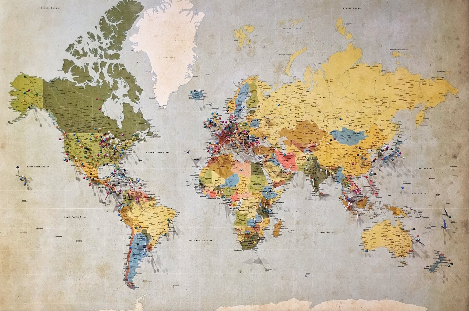
Today, advances in modern technology ensure that no part of Earth’s surface remains unmapped.
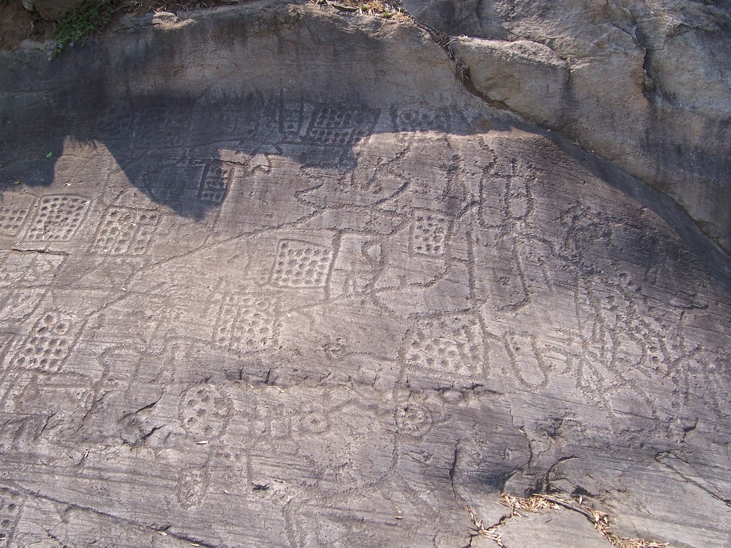
Rock map – c.1500 BCE
Rock Map. By Luca Giarelli – Own work, CC BY-SA 3.0, https://commons.wikimedia.org/w/index.php?curid=4053723
Dots and lines carved on a rock face at Bedolina in northern Italy are believed to represent fields of crops, pathways, and houses. It is thought to be one of the oldest maps in existence.
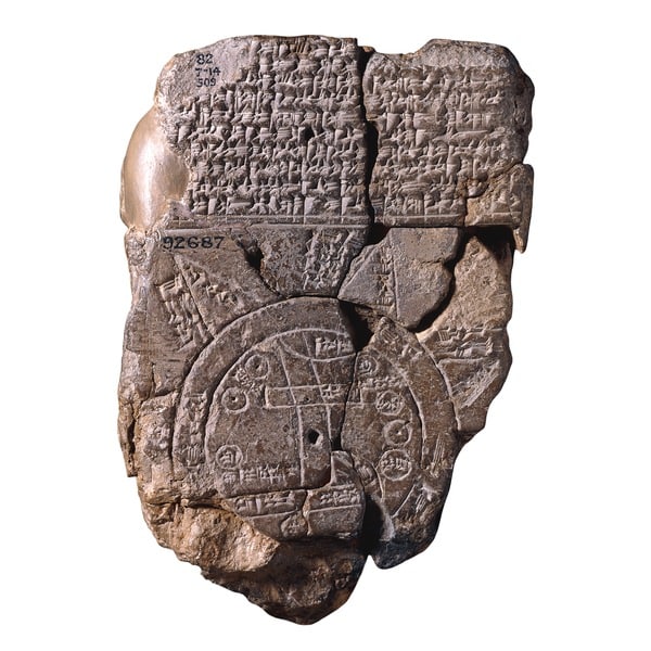
Disc world – c.550 BCE
A map from ancient Mesopotamia (modern-day Iraq) is inscribed on a clay tablet. It shows the world as a disc surrounded by a ring of water, with the city of Babylon at the center.
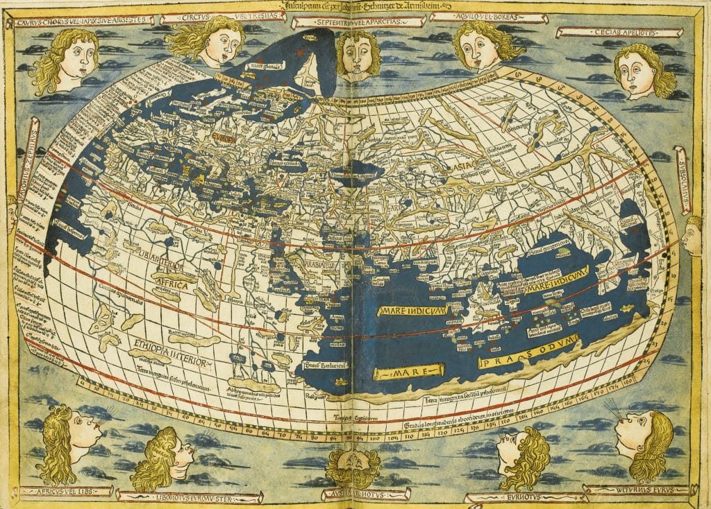
Greek geographer – c. 150 BCE
Photo by Fine Art Images/Heritage Images/Getty Images
The Roman-Greek scholar Claudius Ptolemy writes and an eight-volume book entitled Geography. He is the first person to use a grid system of lines to map Earth and to place North at the top.
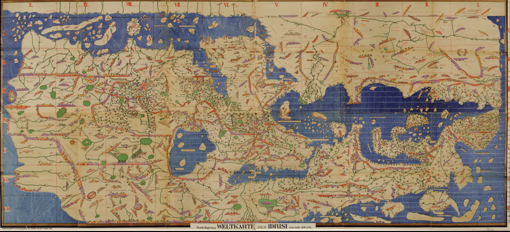
Islamic map – 1154
The circular world map by al-idrisi, a Muslim geographer, shows the south at the very top. Early lived north of Mecca and so prayed facing south. They, therefore, give it importance at the top of the map.
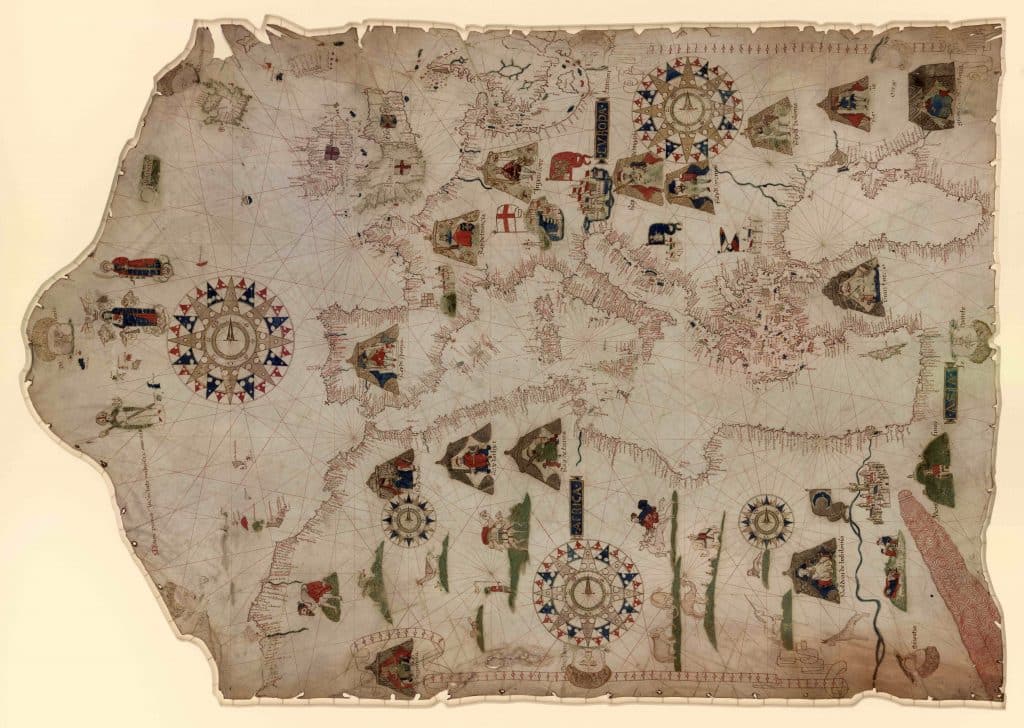
Navigational maps – 1300s – 1500s
Maps called “portolans,” which show coastlines in detail, are in use in southern Europe. Seafarers can plot a course from port to port by following a network of lines.
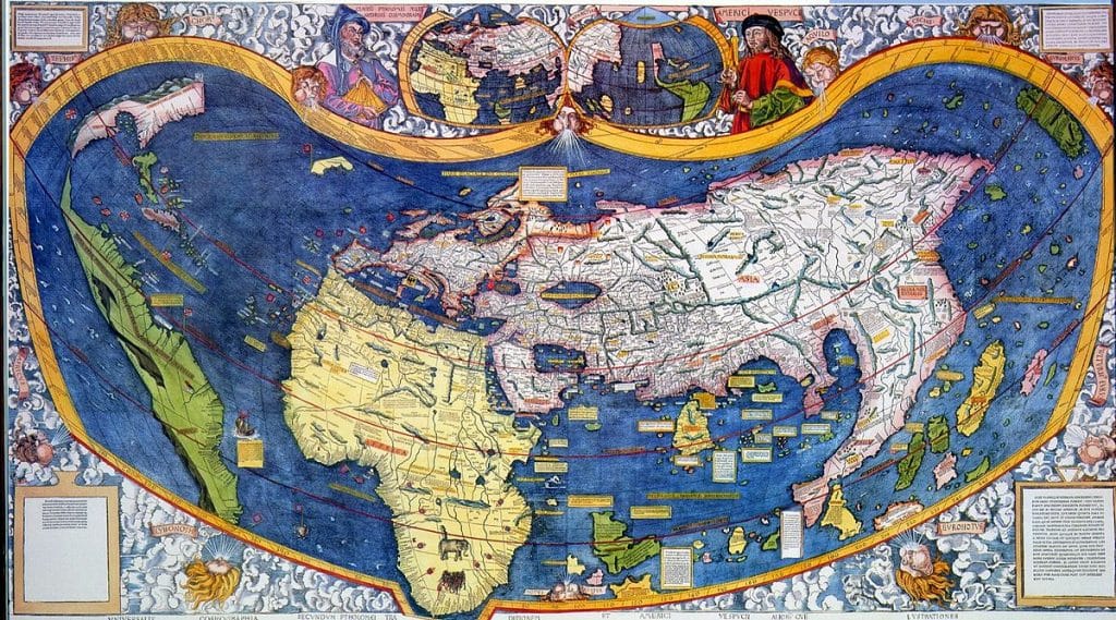
Martin Waldseemuller’s map– 1507
German mapmaker Martin Waldseemuller produces the world’s first map showing America as a separate continent. He supposedly names the land mass after Italian explorer Amerigo Vespucci.
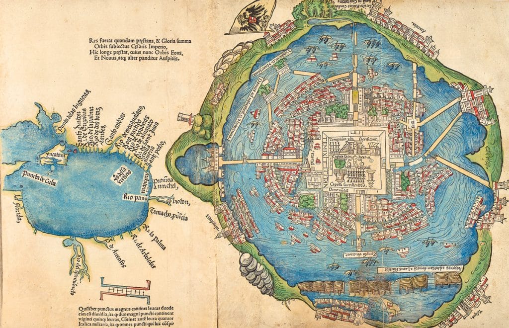
Aztec map – 1542
In this Aztec map, Tenochtlian, the capital city destroyed by the Spanish territory in 1521, is represented by an eagle landing on a cactus. Today, this symbol appears on the flag of modern-day Mexico.
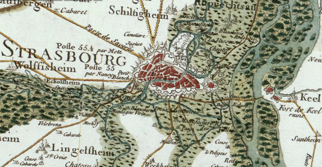
Scientific mapping – 1750-1815
Three generations of the Cassini family are employed in making the Map of France, the first complete cartographic survey of a nation using modern surveying techniques.
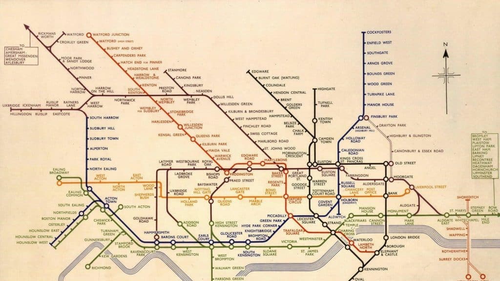
Transportation map – 1913
Harry Beck’s map of the London Underground shows the transit network as a diagram. It does not reflect actual directions and distances, but it is very clear, which makes it easier to follow.
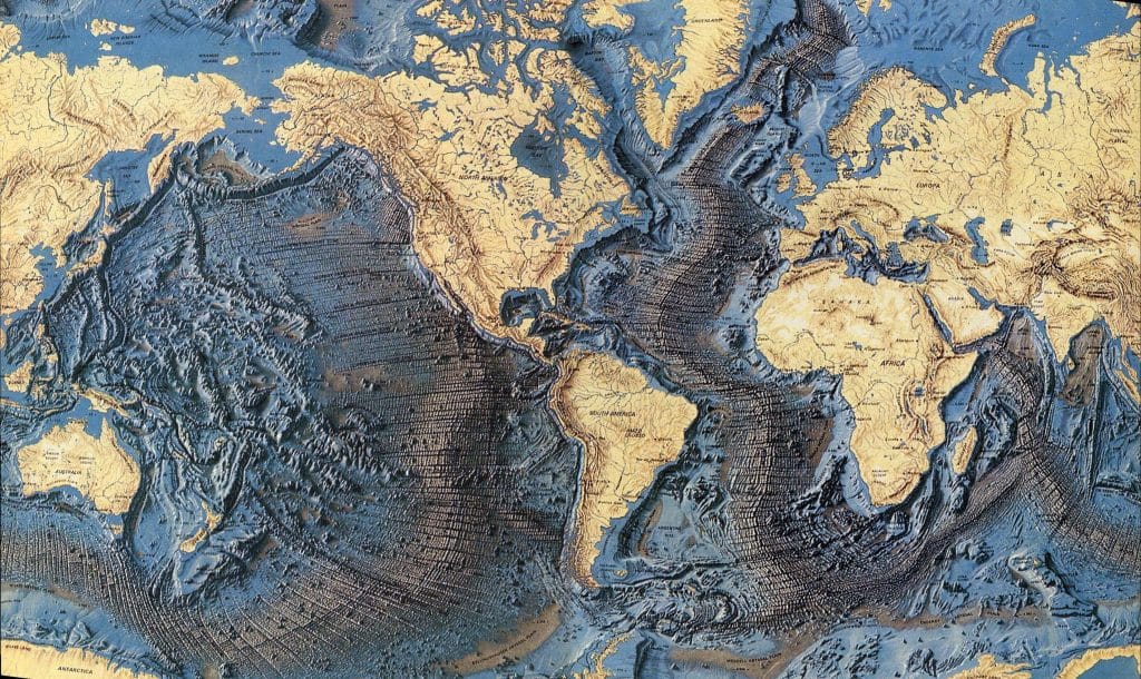
Ocean floor map – 1955-1977
Geologists Marie Tharp and Bruce Heezen create the first scientific map of the Earth’s ocean floor. It reveals a previously unknown landscape of marring ridges and trenches.
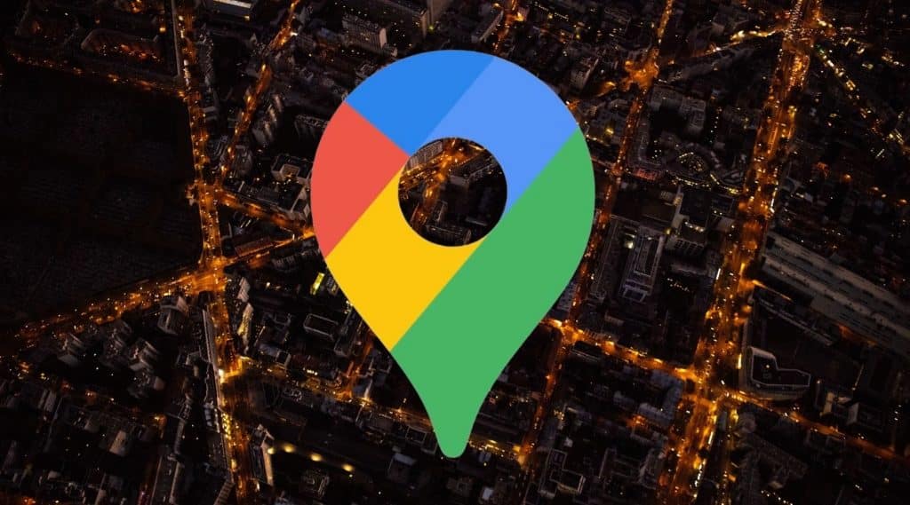
Google Earth – 2005
The computer program Google Earth is launched. It maps Earth by superimposing images obtained from satellites or aircraft and allows users to zoom in on cities and landscapes on their mobile phone, tablet, or computer.